 PHOTOGRAPH ONE:
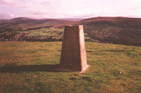
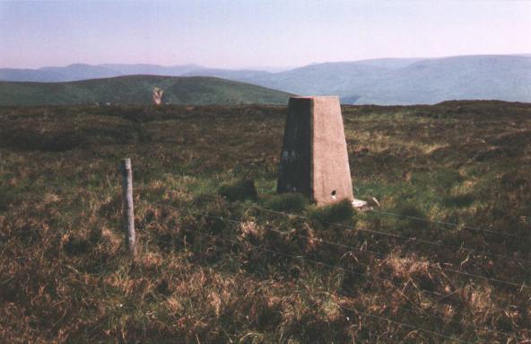
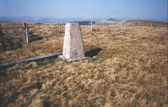
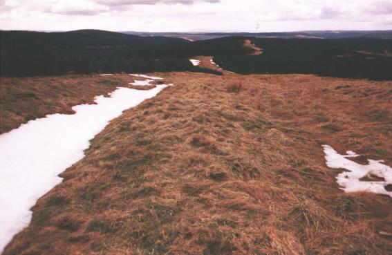
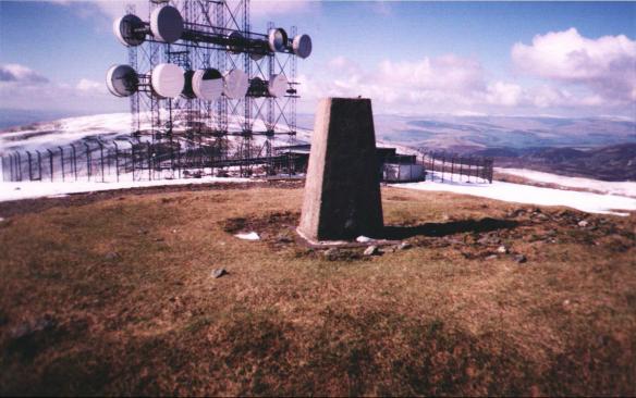
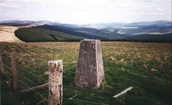
O.S. Column, Warb Law, Langholm. Whita Hill on right horizon. Taken on 22nd August 1993. Section A, Route 3.
Beside each image is a description of the panorama and to which of the aforementioned route(s) it is relevant. For example, the photograph showing Tudhope Hill from Little Tudhope Hill relates to Section B, Route One.
Each thumbnail is linked to a larger version of the photograph.
PHOTOGRAPH ONE:
O.S. Column, Warb Law, Langholm. Whita Hill on right horizon. Taken on
22nd August 1993. Section A, Route 3.
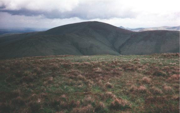
 PHOTOGRAPH TWO:
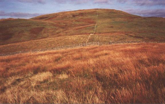
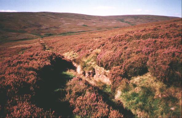
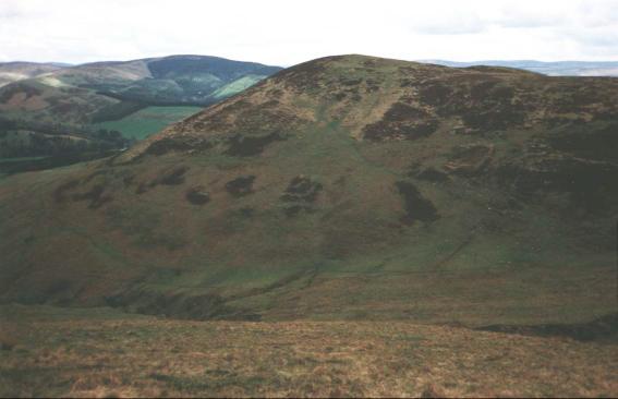
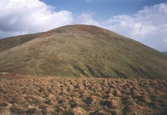
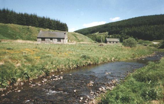
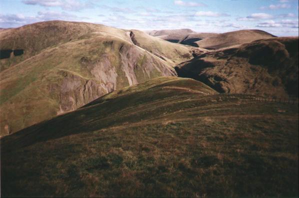
Mid Hill (locally known as "Timpen") from Meikleholm Hill, Langholm. Taken on 26th September 1993. Section A, Routes 3,4 and 5.
 PHOTOGRAPH THREE:
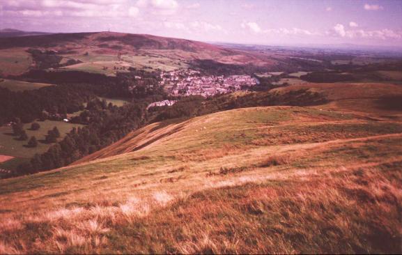
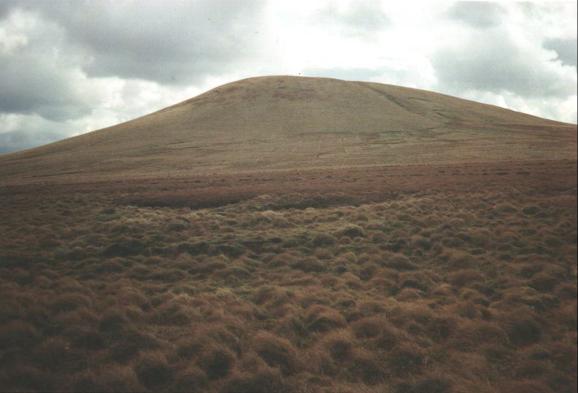
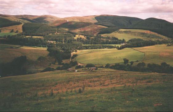
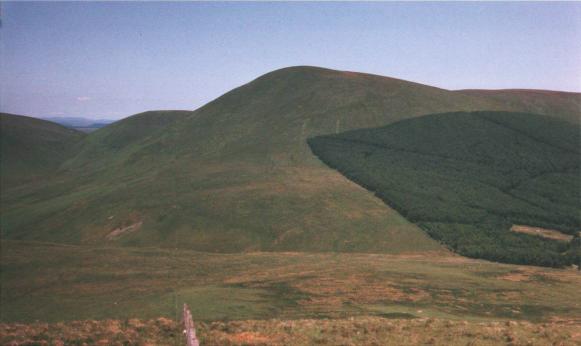
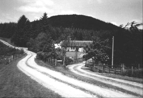
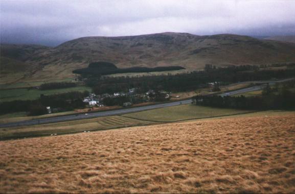
Langholm and Whita Hill from north flank of Mid Hill. Taken during August
1997. Section A, Routes 3,4 and 5.
 PHOTOGRAPH FOUR:
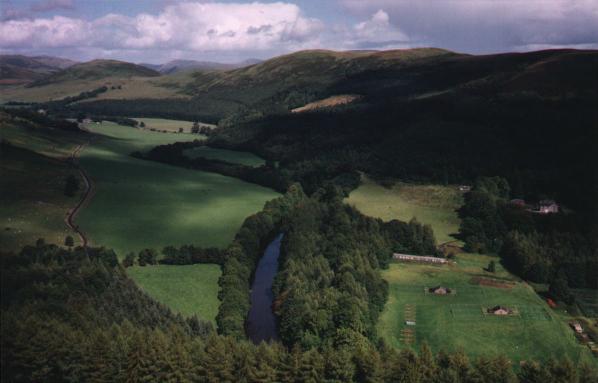
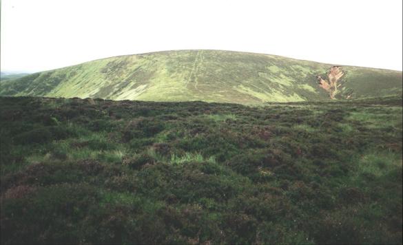
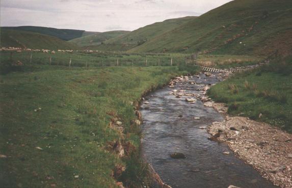
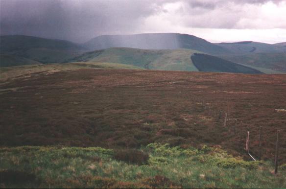
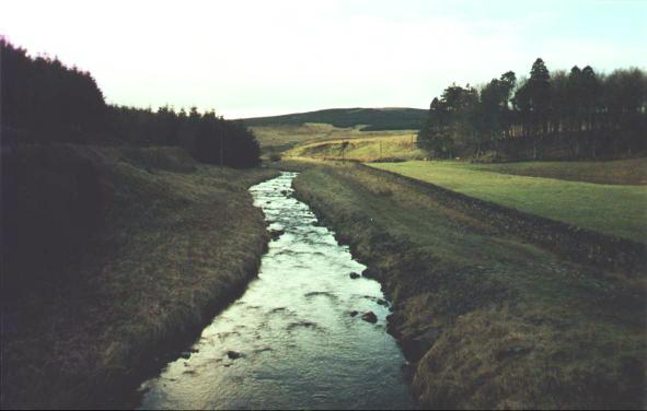
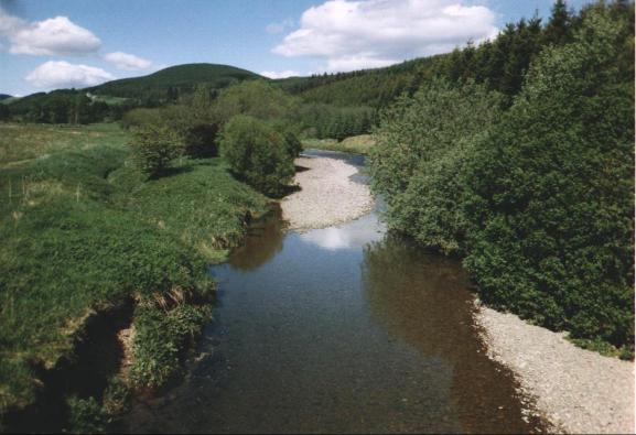
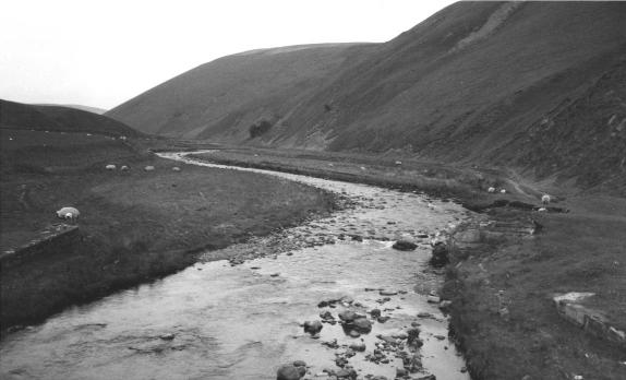
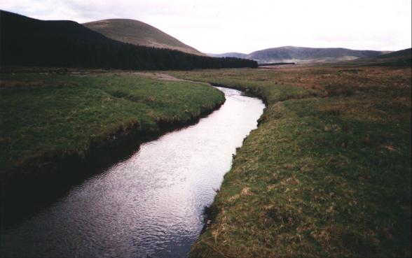
River Esk and, from left to right, the Wrae Hill/Potholm Hill/Castle Hill
ridge viewed from nouth flank of Mid Hill. Taken on 5th September 1994.
Slight detour from Section A, Routes 3,4 and 5.
 PHOTOGRAPH FIVE:
Eskdale from Bucht Rig. Taken on 21st August 1993. Section A, Route 4.
 PHOTOGRAPH SIX:
Bombie Hill from Bucht Rig. Taken on 18th May 1996. Section A, Route 4.
 PHOTOGRAPH SEVEN:
Clagberry Hill from west flank of Craighope Head. Taken on 4th March
1997. Section A, Routes 3 and 4.
 PHOTOGRAPH EIGHT:
Logan Water: west flank of Tansy Hill on right. Taken on 30th June 1994.
Section A, Route 3.
 PHOTOGRAPH NINE:
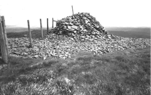
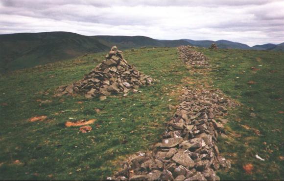
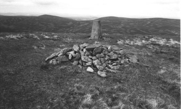
Cairns on Potholm Hill, Langholm. Taken on 18th June 1996. Section A,
Route 1 and Section L, Route 4.
 PHOTOGRAPH TEN:
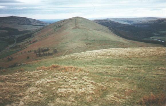
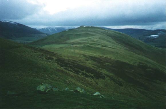
Potholm Hill from Wrae Hill, Langholm. Taken on 16th April 1994. Section
A, Route 1 and Section L, Route 4.
 PHOTOGRAPH ELEVEN:
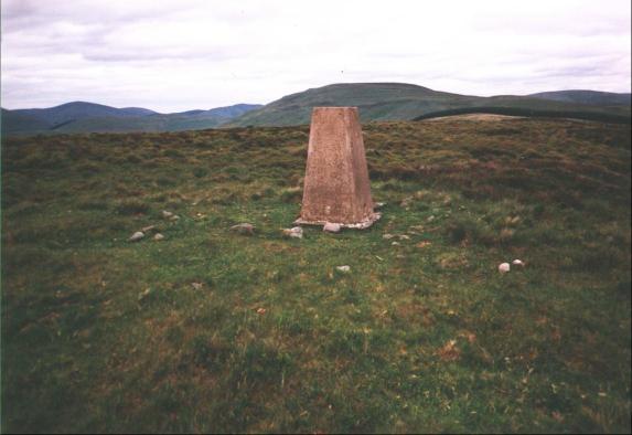
O.S. Column on Hog Fell: Arkleton Hill on mid-horizon. Taken on 18th June
1996. Section A, Route 1.
 PHOTOGRAPH TWELVE:
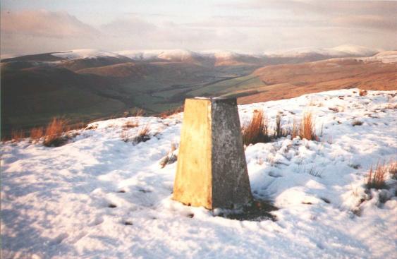
O.S. Column on Whita Hill, Langholm. Taken on 7th January 1994. Section
A, Routes 1 and 2, plus Section L, Route 6.
 PHOTOGRAPH THIRTEEN:
Little Tarras Water Glen from Middlemoss. Terrona Hill (left) and Broad
Head (right) horizon. Taken during September 1997. Section A, Route 2.
 PHOTOGRAPH FOURTEEN:
Tinnis Hill from Burrowstown Moss. Taken on 25th March 1994. Although not
included in any of the routes, this prominent elevation - situated in
Roxburghshire near the boundary with Dumfriesshire - affords magnificent
views of "Borders Reivers" country.
 PHOTOGRAPH FIFTEEN:
Crumpton Hill from Longgrain Head. Taken on 15th July 1996. Section L,
Route 4.
 PHOTOGRAPH SIXTEEN:
O.S. Column on Crumpton Hill. Taken on 26th June 1995. Section A, Route 5
and Section L, Route 4.
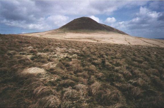
 PHOTOGRAPH SEVENTEEN:
Pikethaw Hill from Ewenshope Fell. Taken on 1st June 1995. Section B,
Routes 3 and 4.
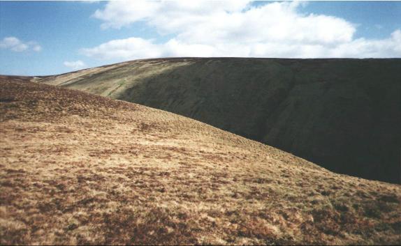
 PHOTOGRAPH EIGHTEEN:
Wisp Hill from Pikethaw Hill. Taken on 1st June 1995. Section B, Routes 3
and 4.
 PHOTOGRAPH NINETEEN:
Storm over Arkleton Hill, viewed from Stibbiegill Head. Taken on 1st June
1995. Section B, Route 4.
 PHOTOGRAPH TWENTY:
Skelfhill Pen, Roxburghshire. Taken on 12th April 1997. Section B, Route
1.
 PHOTOGRAPH TWENTY-ONE:
Cauldcleuch Head from Langtae Hill, Roxburghshire. Taken on 12th April
1997. Section B, Route 1.
 PHOTOGRAPH TWENTY-TWO:
O.S. Column on Tudhope Hill. The fence marks the boundary of
Dumfriesshire and Roxburghshire. Taken on 12th April 1997. Section B, Route
1.
 PHOTOGRAPH TWENTY-THREE:
Tudhope Hill from Little Tudhope Hill. Taken on 12th April 1997. Section
B, Route 1.
 PHOTOGRAPH TWENTY-FOUR:
Tudhope Hill from Geordie's Hill. Taken on 23rd June 1995. Section B,
Route 5.
 PHOTOGRAPH TWENTY-FIVE:
Howpasley Burn at Howpasley, Craik Forest. Taken during March 1996.
Section C, Route 1.
 PHOTOGRAPH TWENTY-SIX:
View South-West across Eskdalemuir Forest from Craik Cross Hill. Taken
during March 1996. Section C, Route 1.
 PHOTOGRAPH TWENTY-SEVEN:
Rae Burn and Raeburnhead, Eskdalemuir Forest. Taken on 17th June 1996.
Section C, Routes 1 and 2.
 PHOTOGRAPH TWENTY-EIGHT:
Kiddamhill, Eskdalemuir Forest. Taken on 22nd June 1996. Section C, Route
3 and Section D, Routes 2 and 3.
 PHOTOGRAPH TWENTY-NINE:
The White Esk between Dumfedling and Garwaldwaterfoot. Taken on 17th June
1996. Section C, Routes 1 and 2.
 PHOTOGRAPH THIRTY:
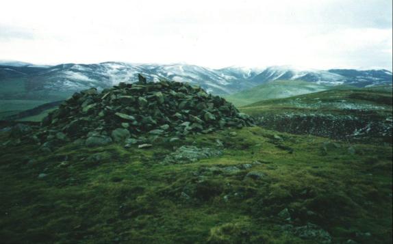
Summit Cairn on Ettrick Pen. Taken on 22nd June 1996. Section D, Route 2.
 PHOTOGRAPH THIRTY-ONE:
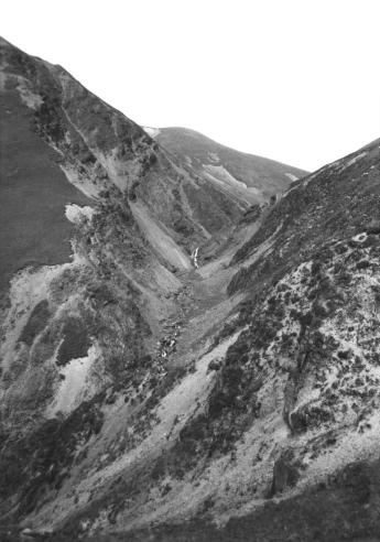
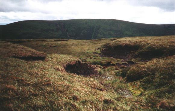
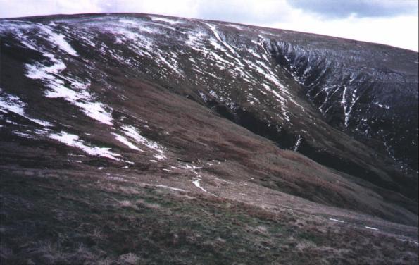
Craigmichen Scar, Ettrick Hills. Taken on 22nd June 1996. Section D,
Route 2.
 PHOTOGRAPH THIRTY-TWO:
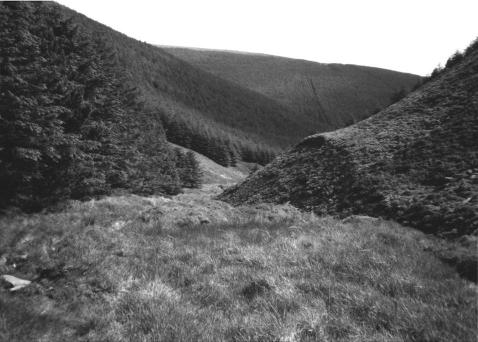
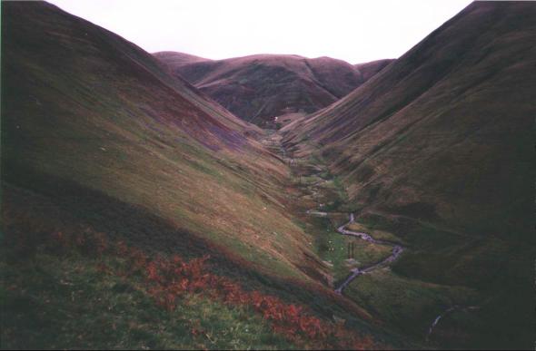
Upper Wamphray Glen: on the Southern Upland Way. Taken on 22nd June 1996.
Section D, Route 2.
 PHOTOGRAPH THIRTY-THREE:
Redgill Craig, Under Saddle Yoke and Saddle Yoke from Falcon Craig,
Moffat Hills. Taken during June 1997. Section E, Route 1.
 PHOTOGRAPH THIRTY-FOUR:
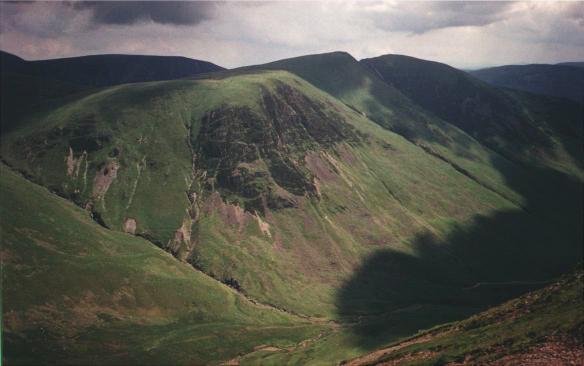
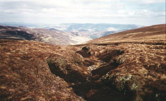
View ENE from summit of Croft Head: Ettrick Pen on horizon, to slightly
right of vertical mid-line. Taken during October 1997. Section E, Route 2.
 PHOTOGRAPH THIRTY-FIVE:
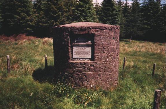
Post-Coach Monument on A701 at Grid Ref. NT052129. Known locally as the
"Postie Stone," it was erected in 1931 to commemorate James
McGeorge and John Goodfellow, respectively guard and driver of the mail coach
en-route to Edinburgh from Dumfries on 20th February 1831. Snow forced them
to abandon their vehicle and carry the mail bags themselves: they succumbed
to exposure and died near the site of the monument. Taken during June 1993.
Section E, Route 3.
 PHOTOGRAPH THIRTY-SIX:
Summit Cairn on Black Meldon, Peebles. Taken during December 1992.
Section F, Route 1.
 PHOTOGRAPH THIRTY-SEVEN:
Cademuir Hill, Peebles. Taken during December 1992. Section F, Routes 1
and 4, and Section L, Route 2.
 PHOTOGRAPH THIRTY-EIGHT:
Dun Rig from Broom Hill, Manor Hills. Taken during July 1992. Section F,
Routes 2 and 4.
 PHOTOGRAPH THIRTY-NINE:
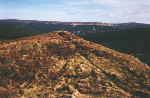
Col between Dun Rig and Stake Law: view northwards down Glensax, Manor
Hills. Taken on 31st March 1997. Section F, Routes 2 and 3, and Section L,
Route 3.
 PHOTOGRAPH FORTY:
Summit of Shieldgreen Kipps, Glentress Forest. Taken on 6th March 1997.
Section F, Route 5.
 PHOTOGRAPH FORTY-ONE:
The River Tweed at Innerleithen. Taken on 5th December 1992. Section F
Routes 3, 5 and 6.
 PHOTOGRAPH FORTY-TWO:
Spango Water and Spango Bank from Spango Bridge: on B740 north of
Crawick, Dumfriesshire. Taken on 15th May 1999. Section G, Route 1.
 PHOTOGRAPH FORTY-THREE:
Stood Hill from Shieling Rig, Lowther Hills. Taken on 17th April 1999.
Section G, Routes 1, 6 and 7, and Section H, Route 5.
 PHOTOGRAPH FORTY-FOUR:
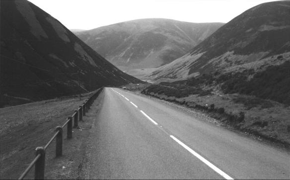
Enterkin Pass from Thirstane Bank, Lowther Hills. Taken during September
1998. Section G, Route 2 and Section H, Route 1.
 PHOTOGRAPH FORTY-FIVE:
Lowther Hill from East Mount Lowther. Taken on 17th April 1999. Section
G, Routes 2 to 6, and Section H, Route 1.
 PHOTOGRAPH FORTY-SIX:
B797 descending through the Mennock Pass, Dumfriesshire. Taken on 16th
May 1999. Section G, Route 3.
 PHOTOGRAPH FORTY-SEVEN:
O.S. Column and N.A.T.S. paraphernalia on the summit of Green Lowther.
Taken on 17th April 1999. Section G, Routes 3 to 6.
 PHOTOGRAPH FORTY-EIGHT:
Summit Cairn and O.S. Column on Louise Wood Law, Lowther Hills. Taken on
14th May 1999. Section G, Route 4.
 PHOTOGRAPH FORTY-NINE:
Abington and, on horizon, Raggengill and Castle Hills from Craighead
Hill. Taken on 12th January 1997. Section H, Route 2.
 PHOTOGRAPH FIFTY:
Potrail Water near Overfingland, Lowther Hills. Taken during May 1997.
Section H, Routes 3 and 4.
 PHOTOGRAPH FIFTY-ONE:
O.S. Column on Clyde Law. Fence marks the boundary of Lanarkshire and
Peeblesshire. Taken during May 1997. Section J, Route 1.
 PHOTOGRAPH FIFTY-TWO:
Looking towards Culter Fell from col between Dod Hill and Hudderstone,
Culter Hills. Taken during March 1999. Section J, Route 2.
 PHOTOGRAPH FIFTY-THREE:
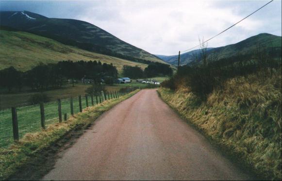
The road to Culter Reservoir: Culter Fell on left. Taken during March
1999. Section J, Route 2.
 PHOTOGRAPH FIFTY-FOUR:
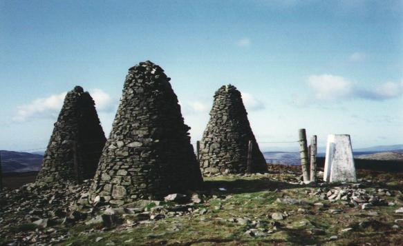
The Three Brethren Cairns and O.S. Column, Selkirkshire. Taken on 10th
October 1992. Section K, Routes 1 and 2.
 PHOTOGRAPH FIFTY-FIVE:
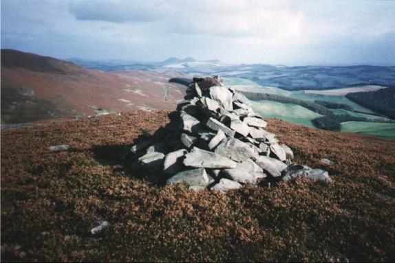
Cairn on southern top of Foulshiels Hill, Selkirkshire: Eildon Hills on
centre horizon. Taken on 9th October 1992. Section K, Route 1.
 PHOTOGRAPH FIFTY-SIX:
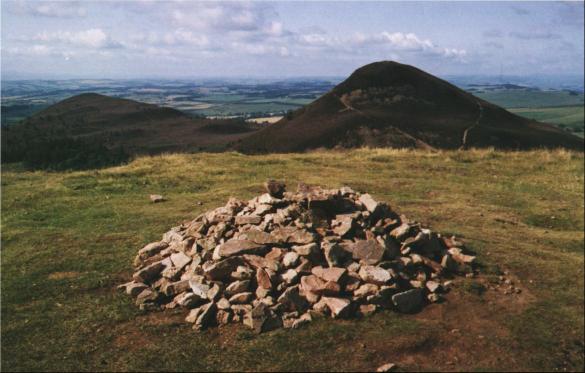
Eildon Wester Hill (left) and Eildon Mid Hill (right) from Eildon Hill
North. Taken on 15th August 1994. Section K, Route 4.
 PHOTOGRAPH FIFTY-SEVEN:
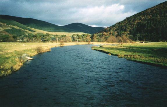
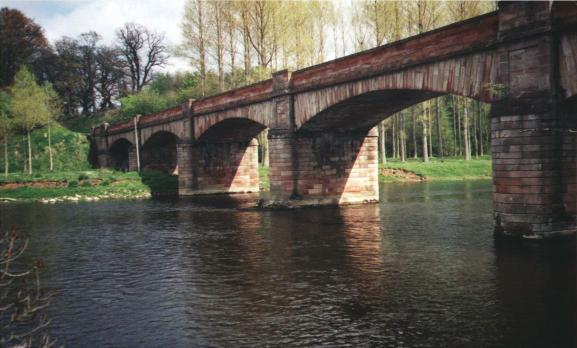
The River Tweed and Mertoun Bridge, St. Boswells. Taken on 9th May 1993.
Section K, Route 4.
 PHOTOGRAPH FIFTY-EIGHT:
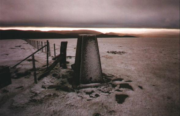
O.S. Column on summit of Broad Law, Tweedsmuir: Hart Fell (Moffat Hills)
on centre horizon. Taken during December 1997. Section L, Route 1.
 PHOTOGRAPH FIFTY-NINE:
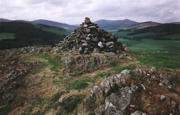
Cairn at Dreva Craig and Hill-Fort, near Broughton. Taken on 10th May
1996. Section L, Route 2.
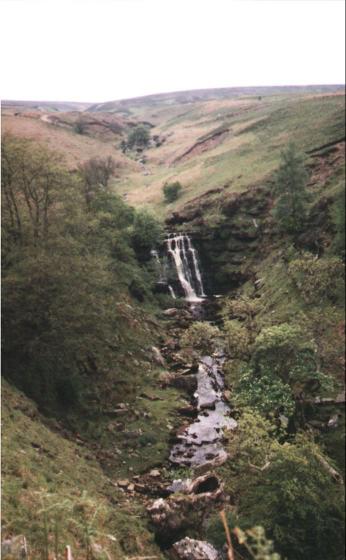 PHOTOGRAPH SIXTY:
Blackburn Falls and Blackburn Linn, near Newcastleton. Taken on 3rd June
1993.
Copyright 23rd August 1999 and 19th September 1999:
RICHARD M. STANBROOK,
"Howden,"
18 Drove Road,
Langholm, Dumfriesshire DG13 OJW.